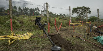
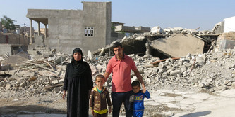
Zypern: 18 Gebiete für Entminung bestätigt
Die Grenze zwischen dem zyprischen und türkischen Bereich ist vermint. Beide Regierungen haben im Rahmen von Vertrauensbildung nun beschlossen, einige Bereiche zu entminen. Fachkräfte der Vereinen Nationen haben 18 entsprechende Gebiete identifiziert. (auf Englisch)

Quelle: CyprusMail online
Eighteen suspected hazardous areas, which may be contaminated with mines, have been identified in Cyprus for clearing as part of confidence-building measure on demining agreed in February between the two leaders in Cyprus.
Nine are situated in the government-controlled areas of the island and nine in the north.
A UN source told the Cyprus News Agency that the 18 areas were identified last week by Unficyp and the United Nations Mine Action Service (Unmas – which is an integral component of the force – in cooperation with the National Guard and with military forces in the north.
...
Lesen Sie hier den vollständigen Artikel